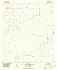
1975 Map of B T Ranch
USGS Topo · Published 1977About this map
B T Ranch and Wimberly Ranch anchor this mid-1970s topographical record of Otero County, revealing the critical water infrastructure required for high-desert cattle operations. The landscape is defined by the drainage patterns of Shiloh Draw and Hackberry Draw, which are complemented by a network of man-made water sources including Potter Tank, Jug Tank, and Badger Well. A notable historical layer is present at CCC Tank, suggesting the legacy of New Deal-era conservation work in this arid region.
Find a feature on this map
19 named features on this map. Tap any name to fly to it.
Don’t see what you’re looking for? This feature index may not catch every label — zoom into the map to look around manually.
Map Details
Editions of this 1975 B T Ranch Map
This is the sole edition of this map. No revisions or reprints were ever made.
Other maps of this area

1940 · Bassett Lake
USGS Topo · 1:62,500

1943 · Pendejo Wash
USGS Topo · 1:62,500

1943 · Bassett Lake
USGS Topo · 1:62,500

1954 · Carlsbad
USGS Topo · 1:250,000

1958 · Carlsbad
USGS Topo · 1:250,000

1959 · Alamo Mountain
USGS Topo · 1:62,500

1975 · Alamo Mountain
USGS Topo · 1:24,000

1975 · Alamo Mountain NE
USGS Topo · 1:24,000
1975 · Cornudas Mountain
USGS Topo · 1:24,000
1979 · Otero Mesa South
USGS Topo · 1:24,000