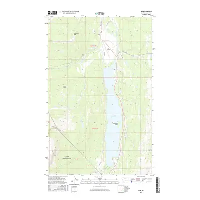
2017 Map of Babb
USGS Topo · Published 2017About this map
Glacier National Park dominates the western half of this landscape, where the high terrain of Swiftcurrent Ridge and Boulder Ridge drops sharply toward the valley below. At the heart of the region, the settlement of Babb serves as a junction near the Saint Mary River and the northern tip of Lower Saint Mary Lake. This 2017 survey illustrates a complex water management and transportation network, including the Saint Mary Canal and a series of local routes like Duck Lake Rd and W Shore Rd. Notable topographic landmarks such as Devils Slide and Beaver Slide suggest a dynamic environment of steep slopes and glacial history, while Thunderbird Island sits prominently within the lake's waters. The inclusion of the Babb Airport highlights the area's role as a modern gateway to the surrounding wilderness.
Find a feature on this map
23 named features on this map. Tap any name to fly to it.
Don’t see what you’re looking for? This feature index may not catch every label — zoom into the map to look around manually.
Map Details
Editions of this 2017 Babb Map
This is the sole edition of this map. No revisions or reprints were ever made.
Other maps of this area

1901 · Browning
USGS Topo · 1:125,000

1903 · Browning
USGS Topo · 1:125,000

1904 · Chief Mountain
USGS Topo · 1:125,000

1938 · Chief Mountain
USGS Topo · 1:125,000

1960 · Cut Bank
USGS Topo · 1:250,000

1963 · Cut Bank
USGS Topo · 1:250,000

1964 · Cut Bank
USGS Topo · 1:250,000

1968 · Saint Mary
USGS Topo · 1:24,000

1968 · Babb
USGS Topo · 1:24,000

1968 · Josephine
USGS Topo · 1:24,000