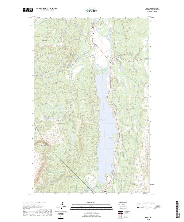
2024 Map of Babb
USGS Topo · Published 2024About this map
Glacier National Park defines the southwestern portion of this landscape, where the high terrain of Boulder Ridge and Swiftcurrent Ridge drops toward the expansive waters of Lower Saint Mary Lake. The community of Babb serves as a northern hub, situated near the head of the Saint Mary Canal and the winding Saint Mary River. This area is characterized by dramatic elevation shifts and narrow valleys carved by Swiftcurrent Creek and Boulder Creek, which feed into the primary lake system. Notable landmarks such as Devils Slide, Thunderbird Island, and Naoi Point emphasize the varied topography. In the south, the settlement of St. Mary sits at a critical junction near where Wild Creek enters the lake, connected by local routes like W Shore Rd and Many Glacier Rd. The map illustrates the complex intersection of federal parkland, water management infrastructure, and the rugged landscape of the eastern Rocky Mountain front.
Find a feature on this map
30 named features on this map. Tap any name to fly to it.
Don’t see what you’re looking for? This feature index may not catch every label — zoom into the map to look around manually.
Map Details
Editions of this 2024 Babb Map
This is the sole edition of this map. No revisions or reprints were ever made.
Other maps of this area

1901 · Browning
USGS Topo · 1:125,000

1903 · Browning
USGS Topo · 1:125,000

1904 · Chief Mountain
USGS Topo · 1:125,000

1938 · Chief Mountain
USGS Topo · 1:125,000

1960 · Cut Bank
USGS Topo · 1:250,000

1963 · Cut Bank
USGS Topo · 1:250,000

1964 · Cut Bank
USGS Topo · 1:250,000

1968 · Saint Mary
USGS Topo · 1:24,000

1968 · Babb
USGS Topo · 1:24,000

1968 · Josephine
USGS Topo · 1:24,000