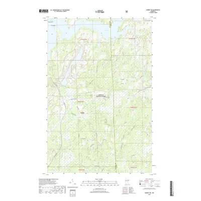
2019 Map of Babbitt NE
USGS Topo · Published 2019About this map
Babbitt sits at the heart of this landscape, positioned where the industrial infrastructure of the Iron Range meets the expansive wilderness of the Superior National Forest. This 2019 survey captures a complex network of resource extraction and recreation roads, notably the Dunka Mine Road and several timber-era spurs like Dunka River Spur B and Hatchet Spur A. The terrain is defined by the significant waters of Birch Lake, including its northern reaches at North Bay and the prominent Birch Point. A labyrinth of smaller streams such as Twenty Proof Cr and the Dunka River wind through the wetlands and forests, illustrating the intricate drainage patterns of the Saint Louis and Lake County border. The presence of the Stony Spur Trail highlights the modern multi-use transition of former industrial or logging corridors within this heavily forested region.
Find a feature on this map
32 named features on this map. Tap any name to fly to it.
Don’t see what you’re looking for? This feature index may not catch every label — zoom into the map to look around manually.
Map Details
Editions of this 2019 Babbitt NE Map
This is the sole edition of this map. No revisions or reprints were ever made.
Other maps of this area

1933 · Ely
USGS Topo · 1:62,500

1939 · Ely
USGS Topo · 1:62,500

1951 · Babbitt SW
USGS Topo · 1:24,000

1951 · Babbitt
USGS Topo · 1:24,000

1952 · Babbitt SE
USGS Topo · 1:24,000

1952 · Babbitt NE
USGS Topo · 1:24,000

1954 · Greenwood Lake
USGS Topo · 1:62,500

1954 · Two Harbors
USGS Topo · 1:250,000

1957 · Two Harbors
USGS Topo · 1:250,000

1957 · Gabbro Lake
USGS Topo · 1:62,500
Featured Places
- Babbitt, MN
- Bassett Township, MN
- Birch Lake (Unorganized Territory), MN
- Lake No. 2, MN
- Stony River Township, MN