
1951 Map of Babbitt SW
USGS Topo · Published 1952About this map
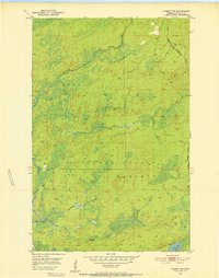
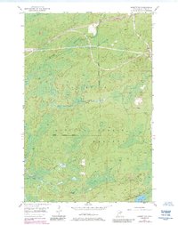
The Reserve Mining Company RR cuts through the northeast corner of this 1951 survey, marking a period of industrial expansion into the Mesabi Range region. This rail line is documented while under construction, illustrating the massive infrastructure required for taconite mining in the mid-20th century. The landscape is dominated by the Superior National Forest and the Bassett state forest area, characterized by a complex network of waterways. The Partridge River meanders across the northern half of the map, while the southern portion features Colvin Creek, Cranberry Cr, and the isolated Stone Lake. The map details the transition from a wilderness-focused timber region to one of heavy industrial connectivity, reflecting a significant shift in the local economy of St. Louis County.
Find a feature on this map
9 named features on this map. Tap any name to fly to it.
Don’t see what you’re looking for? This feature index may not catch every label — zoom into the map to look around manually.
Map Details
Editions of this 1951 Babbitt SW Map
6 editions found
Other maps of this area

1949 · Isaac Lake
USGS Topo · 1:24,000

1949 · Allen
USGS Topo · 1:24,000

1950 · Isaac Lake
USGS Topo · 1:24,000

1950 · Allen
USGS Topo · 1:24,000

1951 · Babbitt
USGS Topo · 1:24,000

1952 · Babbitt SE
USGS Topo · 1:24,000

1952 · Babbitt NE
USGS Topo · 1:24,000

1954 · Two Harbors
USGS Topo · 1:250,000

1954 · Hibbing
USGS Topo · 1:250,000

1957 · Two Harbors
USGS Topo · 1:250,000