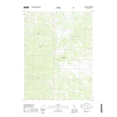
2021 Map of Babcock Peak
USGS Topo · Published 2021About this map
Babcock Peak and Papoose Peak anchor this high-elevation landscape within the Plumas National Forest. The map documents a complex system of drainage and seasonal water sources, defined by the winding paths of Last Chance Creek and Squaw Queen Cr. Broad open spaces such as Babcock Meadows and Squaw Valley indicate the varied topography of this Sierra Nevada region. Human activity is evidenced by the prominent Beckworth Genesee Rd, a historical artery through the mountains. Numerous named water sources, including Murdock Crossing Spring and Section Fifteen Spring, provide critical points of reference for local history and land use. The presence of Red Clover Cr and Meadow Cr further illustrates the watershed patterns that have shaped the region's ranching and forestry traditions.
Find a feature on this map
23 named features on this map. Tap any name to fly to it.
Don’t see what you’re looking for? This feature index may not catch every label — zoom into the map to look around manually.
Map Details
Editions of this 2021 Babcock Peak Map
This is the sole edition of this map. No revisions or reprints were ever made.
Other maps of this area

1886 · Honey Lake
USGS Topo · 1:250,000

1890 · Sierraville
USGS Topo · 1:125,000

1891 · Downieville
USGS Topo · 1:125,000

1891 · Honey Lake
USGS Topo · 1:250,000

1892 · Sierraville
USGS Topo · 1:125,000

1893 · Honey Lake
USGS Topo · 1:250,000

1893 · Downieville
USGS Topo · 1:125,000

1894 · Sierraville
USGS Topo · 1:125,000

1895 · Downieville
USGS Topo · 1:125,000

1896 · Downieville
USGS Topo · 1:125,000