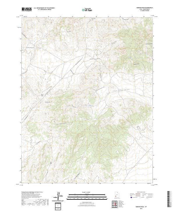
2023 Map of Baboon Peak
USGS Topo · Published 2023About this map
Black Mountains dominate the central landscape of this Iron County region, creating a rugged backdrop for a series of ephemeral water sources and remote travel corridors. The map documents a traditional network of utilitarian routes, including the long-stretching Old Telephone Pole Line and its various branches like the Poleline Cutoff. These infrastructure markings, alongside the Old Telephone Rd, trace the historical advancement of communication through the high desert.
Find a feature on this map
26 named features on this map. Tap any name to fly to it.
Don’t see what you’re looking for? This feature index may not catch every label — zoom into the map to look around manually.
Map Details
Editions of this 2023 Baboon Peak Map
This is the sole edition of this map. No revisions or reprints were ever made.
Other maps of this area

1885 · St. George
USGS Topo · 1:250,000

1885 · Beaver
USGS Topo · 1:250,000

1886 · Kanab
USGS Topo · 1:250,000

1891 · St. George
USGS Topo · 1:250,000

1950 · Enoch
USGS Topo · 1:62,500

1950 · Enoch NE
USGS Topo · 1:24,000
1952 · Enoch NW
USGS Topo · 1:24,000

1952 · Enoch NE
USGS Topo · 1:24,000

1953 · Ninemile Knoll
USGS Topo · 1:24,000

1953 · Minersville
USGS Topo · 1:24,000