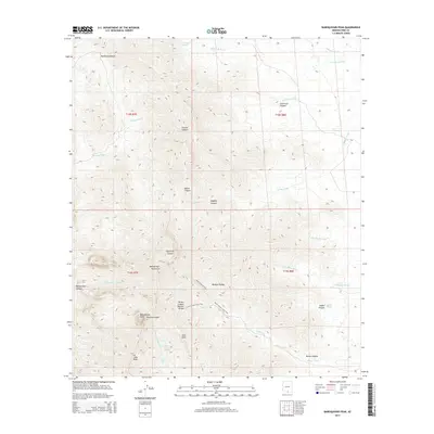
2014 Map of Baboquivari Peak
USGS Topo · Published 2014About this map
Baboquivari Peak dominates the skyline of the Baboquivari Mountains, a range defined by its deep drainages and distinctive high-elevation features. This area in southern Arizona is characterized by a network of seasonal watercourses like Mulberry Wash and Chiltepines Wash, which have carved canyons such as Fresnal Canyon and Contreras Canyon over millennia. The map details a landscape where traditional water sources are critical, marked by Broken Trough Spring, Tinaja Spring, and Max Seep.
Find a feature on this map
37 named features on this map. Tap any name to fly to it.
Don’t see what you’re looking for? This feature index may not catch every label — zoom into the map to look around manually.
Map Details
Editions of this 2014 Baboquivari Peak Map
This is the sole edition of this map. No revisions or reprints were ever made.
Other maps of this area

1920 · Arivaca
USGS Topo · 1:125,000

1940 · Palo Alto Ranch
USGS Topo · 1:62,500

1941 · Presumido Peak
USGS Topo · 1:62,500

1941 · Baboquivari Peak
USGS Topo · 1:62,500

1941 · Arivaca
USGS Topo · 1:62,500

1943 · Fresnal
USGS Topo · 1:125,000

1943 · Arivaca
USGS Topo · 1:62,500

1943 · Palo Alto Ranch
USGS Topo · 1:62,500

1943 · Presumido Peak
USGS Topo · 1:62,500

1944 · Baboquivari Peak
USGS Topo · 1:62,500