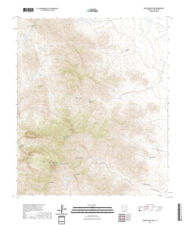
2021 Map of Baboquivari Peak
USGS Topo · Published 2021About this map
Baboquivari Peak serves as the dominant anchor of this section of the Baboquivari Mountains in Pima County. The landscape is a network of deep drainages including Fresnal Canyon and Brown Canyon, where geological features such as the Brown Canyon Natural Bridge and Brown Canyon Arch are documented. Water sources, vital in this arid environment, are specifically identified at Broken Trough Spring, Tinaja Spring, and Max Seep. The map also illustrates human imprints through ranching-related infrastructure like Virtud Tank and Diablo Tank, as well as remote pathways such as the Jaguar Canyon Trl. Notable summits like La Jolla Peak and the curious landmark Itois Eyes provide further topographical context for this high-elevation desert terrain.
Find a feature on this map
39 named features on this map. Tap any name to fly to it.
Don’t see what you’re looking for? This feature index may not catch every label — zoom into the map to look around manually.
Map Details
Editions of this 2021 Baboquivari Peak Map
This is the sole edition of this map. No revisions or reprints were ever made.
Other maps of this area

1920 · Arivaca
USGS Topo · 1:125,000

1940 · Palo Alto Ranch
USGS Topo · 1:62,500

1941 · Presumido Peak
USGS Topo · 1:62,500

1941 · Baboquivari Peak
USGS Topo · 1:62,500

1941 · Arivaca
USGS Topo · 1:62,500

1943 · Fresnal
USGS Topo · 1:125,000

1943 · Arivaca
USGS Topo · 1:62,500

1943 · Palo Alto Ranch
USGS Topo · 1:62,500

1943 · Presumido Peak
USGS Topo · 1:62,500

1944 · Baboquivari Peak
USGS Topo · 1:62,500