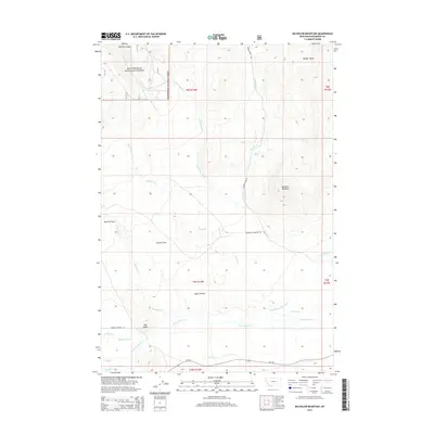
2014 Map of Bachelor Mountain
USGS Topo · Published 2014About this map
The high-altitude drainage systems of Beaverhead National Forest dominate this topography in southwest Montana. At the center of the landscape lies the expansive Horse Prairie, a region defined by its wide, open basins including Poverty Flats and Coyote Flats. The presence of the Mansfield-Prohosky Ditch, Prohosky Ditch, and Pierce Ditch indicates a managed water system designed to support ranching or agriculture in this arid high-country environment. Significant landmarks such as Bachelor Mountain and Red Butte rise above the basin floor, providing vertical relief in a territory carved by numerous drainages like Horse Prairie Creek and Bloody Dick Creek. Transportation is limited to a handful of routes, including MT-324 and Bachelor Mountain Road, which follow the natural contours of the valley floors to connect these remote mountain landmarks.
Find a feature on this map
31 named features on this map. Tap any name to fly to it.
Don’t see what you’re looking for? This feature index may not catch every label — zoom into the map to look around manually.
Map Details
Editions of this 2014 Bachelor Mountain Map
This is the sole edition of this map. No revisions or reprints were ever made.
Other maps of this area

1955 · Dubois
USGS Topo · 1:250,000

1955 · Dillon
USGS Topo · 1:250,000

1957 · Dillon
USGS Topo · 1:250,000

1958 · Dubois
USGS Topo · 1:250,000

1958 · Dillon
USGS Topo · 1:250,000

1959 · Grant
USGS Topo · 1:62,500

1962 · Dillon
USGS Topo · 1:250,000

1965 · Dillon
USGS Topo · 1:250,000

1965 · Jeff Davis Peak
USGS Topo · 1:24,000
1965 · Hansen Ranch
USGS Topo · 1:24,000