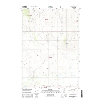
2017 Map of Bachelor Mountain
USGS Topo · Published 2017About this map
Bachelor Mountain and the surrounding high country of the Beaverhead National Forest dominate this 2017 survey of southwestern Montana. The landscape is defined by its complex hydrology and high-altitude basins, notably Horse Prairie and the aptly named Poverty Flats and Coyote Flats. A network of water management features, such as the Mansfield-Prohosky Ditch, Prohosky Ditch, and Pierce Ditch, illustrates the ongoing importance of irrigation in this arid ranching environment.
Find a feature on this map
33 named features on this map. Tap any name to fly to it.
Don’t see what you’re looking for? This feature index may not catch every label — zoom into the map to look around manually.
Map Details
Editions of this 2017 Bachelor Mountain Map
This is the sole edition of this map. No revisions or reprints were ever made.
Other maps of this area

1955 · Dubois
USGS Topo · 1:250,000

1955 · Dillon
USGS Topo · 1:250,000

1957 · Dillon
USGS Topo · 1:250,000

1958 · Dubois
USGS Topo · 1:250,000

1958 · Dillon
USGS Topo · 1:250,000

1959 · Grant
USGS Topo · 1:62,500

1962 · Dillon
USGS Topo · 1:250,000

1965 · Dillon
USGS Topo · 1:250,000

1965 · Jeff Davis Peak
USGS Topo · 1:24,000
1965 · Hansen Ranch
USGS Topo · 1:24,000