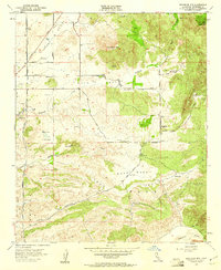
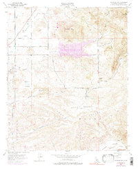
1953 Map of Bachelor Mtn.
USGS Topo · Published 1961About this map
The agricultural and ranching landscape of Riverside County unfolds across several prominent basins including French Valley, Auld Valley, and Pauba Valley. This mid-century landscape is defined by its water management infrastructure, most notably the Diego Aqueduct and Two Pipelines cutting north-to-south across the western terrain. Scattered landmarks like the Auld Ranch and various named windmills suggest a rural economy centered on livestock and dry farming before modern suburban expansion.
Find a feature on this map
48 named features on this map. Tap any name to fly to it.
Don’t see what you’re looking for? This feature index may not catch every label — zoom into the map to look around manually.
Map Details
Editions of this 1953 Bachelor Mtn. Map
6 editions found
Other maps of this area

1901 · Southern California Sheet No. 1
USGS Topo · 1:250,000

1901 · San Jacinto
USGS Topo · 1:125,000

1901 · Elsinore
USGS Topo · 1:125,000

1901 · San Luis Rey
USGS Topo · 1:125,000

1903 · Ramona
USGS Topo · 1:125,000

1904 · Southern California Sheet No. 2
USGS Topo · 1:250,000

1904 · Southern California Sheet No. 1
USGS Topo · 1:250,000

1939 · Palomar Mountain
USGS Topo · 1:62,500

1942 · Temecula
USGS Topo · 1:62,500

1942 · Hemet
USGS Topo · 1:62,500