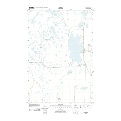
2010 Map of Backus
USGS Topo · Published 2010About this map
Backus serves as the central hub of this northern Minnesota landscape, situated along the eastern shore of Pine Mountain Lake. The settlement pattern is defined by its proximity to water and transport, with the Backus Post Office and Evergreen Cemetery anchoring the town site. The map captures a transition in land use, where the Paul Bunyan Trl follows a former railroad grade through town, reflecting the shift from industrial timber hauling to modern recreational trails.
Find a feature on this map
43 named features on this map. Tap any name to fly to it.
Don’t see what you’re looking for? This feature index may not catch every label — zoom into the map to look around manually.
Map Details
Editions of this 2010 Backus Map
This is the sole edition of this map. No revisions or reprints were ever made.
Other maps of this area

1919 · Leader
USGS Topo · 1:62,500

1953 · Brainerd
USGS Topo · 1:250,000

1957 · Brainerd
USGS Topo · 1:250,000

1958 · Brainerd
USGS Topo · 1:250,000

1959 · Pine River
USGS Topo · 1:24,000

1965 · Brainerd
USGS Topo · 1:250,000

1970 · Spider Lake
USGS Topo · 1:24,000

1970 · Backus
USGS Topo · 1:24,000

1970 · Hackensack
USGS Topo · 1:24,000
1970 · Bungo Creek
USGS Topo · 1:24,000