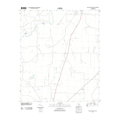
2011 Map of Baconton South
USGS Topo · Published 2011About this map
The Flint River meanders through the northwest corner of this Mitchell County landscape, creating notable geographic features such as Horseshoe Bend and Prossers Island. This 2011 survey documents a predominantly rural environment defined by agricultural tracts and small settlements like Flint and Adelaide. The hydrology is particularly distinct, with Wethington Slough cutting through the eastern half of the map, while Rock Pond and Rock Lake sit in the southwestern quadrant.
Find a feature on this map
38 named features on this map. Tap any name to fly to it.
Don’t see what you’re looking for? This feature index may not catch every label — zoom into the map to look around manually.
Map Details
Editions of this 2011 Baconton South Map
This is the sole edition of this map. No revisions or reprints were ever made.
Other maps of this area

1953 · Dothan
USGS Topo · 1:250,000

1954 · Dothan
USGS Topo · 1:250,000

1955 · Dothan
USGS Topo · 1:250,000

1956 · Baconton
USGS Topo · 1:62,500

1956 · Newton
USGS Topo · 1:62,500

1971 · Camilla
USGS Topo · 1:24,000

1971 · Cotton
USGS Topo · 1:24,000
1971 · Branchville
USGS Topo · 1:24,000
1974 · Putney
USGS Topo · 1:24,000
1974 · Baconton South
USGS Topo · 1:24,000