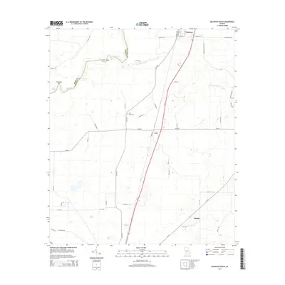
2014 Map of Baconton South
USGS Topo · Published 2014About this map
Flint River meanders along the western edge of this Mitchell County landscape, creating prominent natural features like Horseshoe Bend and Prossers Island. The geography is defined by its water sources, from the expansive Wethington Slough to smaller localized springs such as Culpepper Spring, Double Springs, and Walton Spring. These water features historically dictated the placement of agricultural tracts and small settlements in this part of Georgia.
Find a feature on this map
52 named features on this map. Tap any name to fly to it.
Don’t see what you’re looking for? This feature index may not catch every label — zoom into the map to look around manually.
Map Details
Editions of this 2014 Baconton South Map
This is the sole edition of this map. No revisions or reprints were ever made.
Other maps of this area

1953 · Dothan
USGS Topo · 1:250,000

1954 · Dothan
USGS Topo · 1:250,000

1955 · Dothan
USGS Topo · 1:250,000

1956 · Baconton
USGS Topo · 1:62,500

1956 · Newton
USGS Topo · 1:62,500

1971 · Camilla
USGS Topo · 1:24,000

1971 · Cotton
USGS Topo · 1:24,000
1971 · Branchville
USGS Topo · 1:24,000
1974 · Putney
USGS Topo · 1:24,000
1974 · Baconton South
USGS Topo · 1:24,000