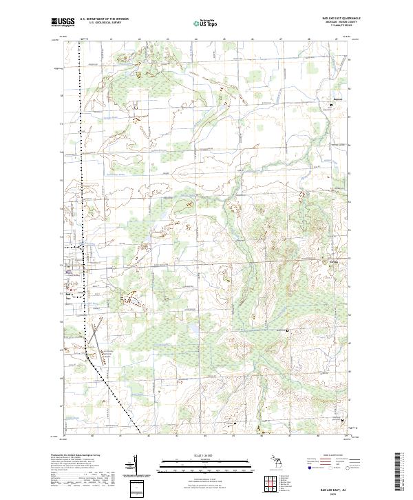
2023 Map of Bad Axe East
USGS Topo · Published 2023About this map
Bad Axe serves as the focal point for this survey of the Michigan Thumb, where the seat of Huron County sits at the intersection of a rigid agricultural grid and a complex drainage network. The eastern edges of the city show significant municipal development, including the Huron County Building and the Huron County Memorial Airport. Outside the central settlement, the landscape is defined by the headwaters of the New River and Willow Creek, supplemented by an extensive system of artificial waterways like Colfax Drain and Symons Drain that allowed for the intensive farming of this flat region. Smaller communities such as Rapson and Verona anchor the outlying sections, surrounded by several well-documented burial grounds including Saint Joseph Cem and the Most Holy Trinity Cem, which provide valuable location data for those tracing local family lineages.
Find a feature on this map
85 named features on this map. Tap any name to fly to it.
Don’t see what you’re looking for? This feature index may not catch every label — zoom into the map to look around manually.
Map Details
Editions of this 2023 Bad Axe East Map
This is the sole edition of this map. No revisions or reprints were ever made.
Other maps of this area

1954 · Flint
USGS Topo · 1:250,000

1958 · Flint
USGS Topo · 1:250,000

1963 · New Greenleaf
USGS Topo · 1:24,000

1963 · Ubly
USGS Topo · 1:24,000

1963 · Minden City
USGS Topo · 1:24,000

1970 · Kinde East
USGS Topo · 1:24,000

1970 · Redman
USGS Topo · 1:24,000

1970 · Kinde West
USGS Topo · 1:24,000

1970 · Bad Axe West
USGS Topo · 1:24,000

1970 · Bad Axe SE
USGS Topo · 1:24,000