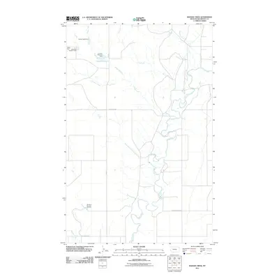
2011 Map of Badger Creek
USGS Topo · Published 2011About this map
The Poplar River meanders heavily through this portion of Roosevelt County, carving a deep, winding channel across the plains. This landscape is defined by its water management and agricultural infrastructure, evidenced by a series of localized water control points such as Barney Rubbel Dam, Wilma Dam, and Crandall Reservoir Dam. These structures suggest a reliance on managed water resources for ranching or irrigation in an area where the drainages of Badger Creek, Flea Creek, and Culbertson Creek converge toward the river valley.
Find a feature on this map
16 named features on this map. Tap any name to fly to it.
Don’t see what you’re looking for? This feature index may not catch every label — zoom into the map to look around manually.
Map Details
Editions of this 2011 Badger Creek Map
This is the sole edition of this map. No revisions or reprints were ever made.
Other maps of this area

1910 · Cuskers
USGS Topo · 1:62,500

1912 · Chelsea
USGS Topo · 1:62,500

1912 · Hay Creek
USGS Topo · 1:62,500

1912 · Poplar
USGS Topo · 1:62,500

1915 · Cuskers
USGS Topo · 1:62,500

1954 · Wolf Point
USGS Topo · 1:250,000

1958 · Wolf Point
USGS Topo · 1:250,000

1972 · Poplar
USGS Topo · 1:24,000

1972 · Chelsea
USGS Topo · 1:24,000

1972 · Poplar NE
USGS Topo · 1:24,000