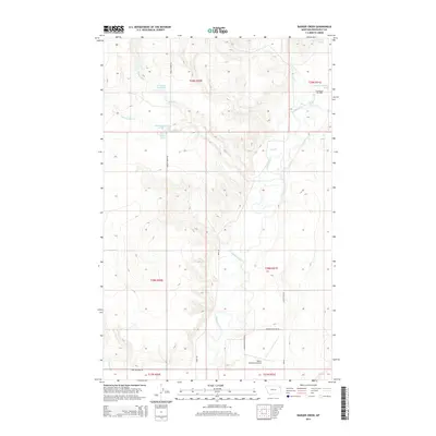
2014 Map of Badger Creek
USGS Topo · Published 2014About this map
The Poplar River winds through this section of Roosevelt County, carving a valley that defines the local geography and transportation routes. In the early 21st century, the landscape reflects a mixture of agricultural water management and energy extraction, most notably at the East Poplar Oil Field in the northeast. Water resources are central to the area's development, with features such as Crandall Reservoir, Little Badger Spring, and various unnamed springs providing essential points of interest for land use studies.
Find a feature on this map
26 named features on this map. Tap any name to fly to it.
Don’t see what you’re looking for? This feature index may not catch every label — zoom into the map to look around manually.
Map Details
Editions of this 2014 Badger Creek Map
This is the sole edition of this map. No revisions or reprints were ever made.
Other maps of this area

1910 · Cuskers
USGS Topo · 1:62,500

1912 · Chelsea
USGS Topo · 1:62,500

1912 · Hay Creek
USGS Topo · 1:62,500

1912 · Poplar
USGS Topo · 1:62,500

1915 · Cuskers
USGS Topo · 1:62,500

1954 · Wolf Point
USGS Topo · 1:250,000

1958 · Wolf Point
USGS Topo · 1:250,000

1972 · Poplar
USGS Topo · 1:24,000

1972 · Chelsea
USGS Topo · 1:24,000

1972 · Poplar NE
USGS Topo · 1:24,000