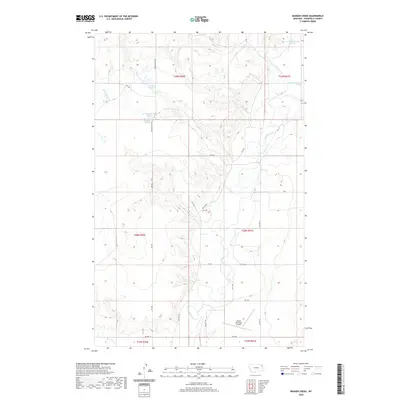
2020 Map of Badger Creek
USGS Topo · Published 2020About this map
Poplar River meanders southward through this corner of Roosevelt County, carving a wide valley floor flanked by broken coulees and prairie uplands. The landscape is defined by its drainage network, including the confluence of Badger Cr and Little Badger Cr, where the small Little Badger Spring and the Crandall Reservoir mark essential water sources in the semi-arid northern plains. Human activity is largely structured by the Public Land Survey System grid and Bureau of Indian Affairs transit routes, such as Bia Rte 150 and Bia Rte 75. Near the southern edge, the Poplar Municipal Airport sits on a level bench above the river, serving as a modern landmark in an area otherwise characterized by remote ranch roads and named seasonal waterways like Flea Cr and Boxelder Cr.
Find a feature on this map
36 named features on this map. Tap any name to fly to it.
Don’t see what you’re looking for? This feature index may not catch every label — zoom into the map to look around manually.
Map Details
Editions of this 2020 Badger Creek Map
This is the sole edition of this map. No revisions or reprints were ever made.
Other maps of this area

1910 · Cuskers
USGS Topo · 1:62,500

1912 · Chelsea
USGS Topo · 1:62,500

1912 · Hay Creek
USGS Topo · 1:62,500

1912 · Poplar
USGS Topo · 1:62,500

1915 · Cuskers
USGS Topo · 1:62,500

1954 · Wolf Point
USGS Topo · 1:250,000

1958 · Wolf Point
USGS Topo · 1:250,000

1972 · Poplar
USGS Topo · 1:24,000

1972 · Chelsea
USGS Topo · 1:24,000

1972 · Poplar NE
USGS Topo · 1:24,000