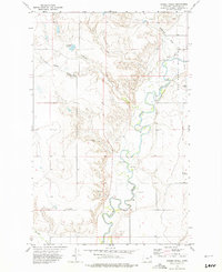
1972 Map of Badger Creek
USGS Topo · Published 1975About this map
The Poplar River meanders across this Roosevelt County landscape, where industrial infrastructure meets the high plains of the Fort Peck Indian Reservation. During the early 1970s, the East Poplar Oil Field dominated the northeastern corner of this area, evidenced by a dense network of Oil Wells and a central Pumping Sta connected by a major Pipeline. This energy-driven landscape is punctuated by agricultural and water management features like Crandall Reservoir and the Storage Bins near the southern boundary.
Find a feature on this map
24 named features on this map. Tap any name to fly to it.
Don’t see what you’re looking for? This feature index may not catch every label — zoom into the map to look around manually.
Map Details
Editions of this 1972 Badger Creek Map
This is the sole edition of this map. No revisions or reprints were ever made.
Other maps of this area

1910 · Cuskers
USGS Topo · 1:62,500

1912 · Chelsea
USGS Topo · 1:62,500

1912 · Hay Creek
USGS Topo · 1:62,500

1912 · Poplar
USGS Topo · 1:62,500

1915 · Cuskers
USGS Topo · 1:62,500

1954 · Wolf Point
USGS Topo · 1:250,000

1958 · Wolf Point
USGS Topo · 1:250,000

1972 · Poplar
USGS Topo · 1:24,000

1972 · Chelsea
USGS Topo · 1:24,000

1972 · Poplar NE
USGS Topo · 1:24,000