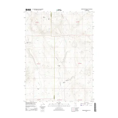
2015 Map of Badger Mountain SE
USGS Topo · Published 2015About this map
The Badger Mountains dominate this high-desert landscape in northern Nevada, where the border of Washoe and Humboldt counties divides the terrain. Water sources are the critical defining feature for this region, evidenced by the dispersal of Domingo Spring, Wheeler Spring, and Bateman Spring across the high elevations. The map reveals a land utilized for ranching, most notably centered on the Soldier Meadows Rnch. Topographic variations are captured through deep cuts such as Wildcat Gorge and the broad opening of Shoestring Valley. Drainage patterns are dictated by the seasonal flows of Wall Canyon Cr and Cottonwood Creek, which have carved out corridors like Little Cottonwood Canyon and Cottonwood Canyon. This 2015 survey provides a modern record of the durable geographic landmarks and sparse human infrastructure in this part of the Sheldon Antelope Range.
Find a feature on this map
25 named features on this map. Tap any name to fly to it.
Don’t see what you’re looking for? This feature index may not catch every label — zoom into the map to look around manually.
Map Details
Editions of this 2015 Badger Mountain SE Map
This is the sole edition of this map. No revisions or reprints were ever made.
Other maps of this area

1889 · Long Valley
USGS Topo · 1:250,000

1954 · Vya
USGS Topo · 1:250,000

1958 · Vya
USGS Topo · 1:250,000

1962 · Vya
USGS Topo · 1:250,000

1965 · Rock Spring Table
USGS Topo · 1:62,500

1966 · Badger Mtn NW
USGS Topo · 1:24,000

1966 · Blowout Mtn
USGS Topo · 1:24,000

1966 · Nut Mountain
USGS Topo · 1:24,000

1966 · Badger Mtn SE
USGS Topo · 1:24,000

1972 · Soldier Meadow
USGS Topo · 1:24,000