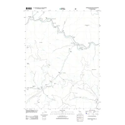
2012 Map of Badger Mountain
USGS Topo · Published 2012About this map
Gottsville sits along a winding bend of the Klamath River in a landscape defined by steep peaks and deep drainage gulches. This Siskiyou County terrain is a study in historical resource extraction and early mountain passage, where the names of river bars and gulches recall a heritage of prospecting and settlement. Near the Klamath River, features like Kanaka Bar, Swiss Bar, and Masonic Bar line the banks, while the Kanaka Cem provides a genealogical anchor for the area.
Find a feature on this map
71 named features on this map. Tap any name to fly to it.
Don’t see what you’re looking for? This feature index may not catch every label — zoom into the map to look around manually.
Map Details
Editions of this 2012 Badger Mountain Map
This is the sole edition of this map. No revisions or reprints were ever made.
Other maps of this area

1886 · Shasta
USGS Topo · 1:250,000

1894 · Shasta
USGS Topo · 1:250,000

1922 · Shasta Valley Sheet No 3
USGS Topo · 1:24,000

1932 · Yreka
USGS Topo · 1:96,000

1939 · Yreka
USGS Topo · 1:125,000

1948 · Weed
USGS Topo · 1:250,000

1950 · Weed
USGS Topo · 1:250,000

1954 · Yreka
USGS Topo · 1:62,500

1955 · Condrey Mtn
USGS Topo · 1:62,500
1955 · Hornbrook
USGS Topo · 1:62,500