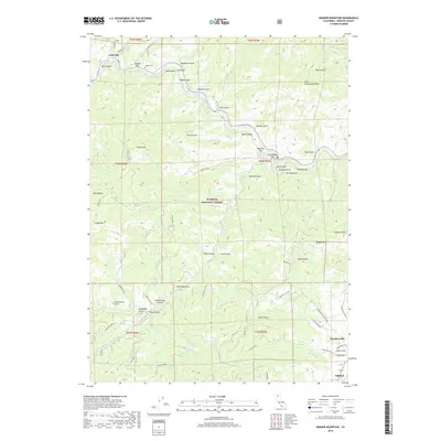
2018 Map of Badger Mountain
USGS Topo · Published 2018About this map
The Klamath River winds through northern Siskiyou County, carving a rugged corridor defined by a series of historic gravel bars and mining claims. This 2018 survey details the transition from the high-elevation peaks of the Klamath National Forest, such as Craggy Mtn and Badger Mtn, down toward the northern edge of Yreka. The landscape is etched with local history, from the Kanaka Cem near Gottsville to the network of traditional mining sites like Kanaka Bar, Swiss Bar, and Masonic Bar.
Find a feature on this map
72 named features on this map. Tap any name to fly to it.
Don’t see what you’re looking for? This feature index may not catch every label — zoom into the map to look around manually.
Map Details
Editions of this 2018 Badger Mountain Map
This is the sole edition of this map. No revisions or reprints were ever made.
Other maps of this area

1886 · Shasta
USGS Topo · 1:250,000

1894 · Shasta
USGS Topo · 1:250,000

1922 · Shasta Valley Sheet No 3
USGS Topo · 1:24,000

1932 · Yreka
USGS Topo · 1:96,000

1939 · Yreka
USGS Topo · 1:125,000

1948 · Weed
USGS Topo · 1:250,000

1950 · Weed
USGS Topo · 1:250,000

1954 · Yreka
USGS Topo · 1:62,500

1955 · Condrey Mtn
USGS Topo · 1:62,500
1955 · Hornbrook
USGS Topo · 1:62,500