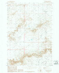
1987 Map of Badland Hills
USGS Topo · Published 1987About this map
The Badland Hills dominate this portion of Park County, showing a landscape defined by intricate drainage patterns and erosion. This 1987 provisional survey reveals the essential infrastructure required to move water through the arid terrain, most notably the Heart Mountain Canal and its associated Pumping Station. These features, along with the Lateral Ditch, suggest a system engineered to support the agricultural potential of the Ralston Flats in the southeast. Natural waterways like the West Fork Big Sand Coulee and Little Sand Coulee carve through the hills, while a series of pipelines and trails cross the high ground, indicating a region utilized for both resource extraction and irrigation. The presence of Alkali Creek further highlights the distinct soil chemistry of this Wyoming landscape during the late twentieth century.
Find a feature on this map
9 named features on this map. Tap any name to fly to it.
Don’t see what you’re looking for? This feature index may not catch every label — zoom into the map to look around manually.
Map Details
Editions of this 1987 Badland Hills Map
This is the sole edition of this map. No revisions or reprints were ever made.
Other maps of this area

1949 · Cody
USGS Topo · 1:62,500

1950 · Clark
USGS Topo · 1:62,500

1951 · Cody
USGS Topo · 1:62,500

1955 · Cody
USGS Topo · 1:250,000

1958 · Cody
USGS Topo · 1:250,000

1962 · Cody
USGS Topo · 1:250,000

1966 · Elk Basin SW
USGS Topo · 1:24,000

1966 · Elk Basin NW
USGS Topo · 1:24,000
1966 · Vocation
USGS Topo · 1:24,000

1980 · Cody
USGS Topo · 1:100,000