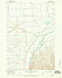
1966 Map of Vocation
USGS Topo · Published 1970About this map
Shoshone River waters and the extensive irrigation network of the Garland Canal define this mid-1960s landscape in Park County. The map documents a sophisticated system of laterals, including Lateral H-103, Lateral H-89, and the Ralston Lateral, which transformed the Ralston Flats into productive agricultural land. These man-made watercourses reflect the reclamation efforts central to Wyoming's development during this era, supporting small community hubs like Vocation and Kamms Corner.
Find a feature on this map
38 named features on this map. Tap any name to fly to it.
Don’t see what you’re looking for? This feature index may not catch every label — zoom into the map to look around manually.
Map Details
Editions of this 1966 Vocation Map
2 editions found
Other maps of this area

1949 · Cody
USGS Topo · 1:62,500

1950 · Clark
USGS Topo · 1:62,500

1951 · Cody
USGS Topo · 1:62,500

1955 · Cody
USGS Topo · 1:250,000

1958 · Cody
USGS Topo · 1:250,000

1962 · Cody
USGS Topo · 1:250,000

1966 · Elk Basin SW
USGS Topo · 1:24,000

1966 · Stone Barn Camp
USGS Topo · 1:24,000

1966 · Elk Basin SE
USGS Topo · 1:24,000

1966 · Corbett Dam
USGS Topo · 1:24,000