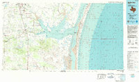
1984 Map of Baffin Bay
USGS Topo · Published 1984About this map
Baffin Bay and its intricate network of secondary bays, including Alazan Bay and Cayo del Grullo, dominate this coastal landscape of Kleberg and Kenedy counties. The map captures a transition from the structured street grid of Kingsville, home to Texas A & I University and the Kingsville Naval Air Station, to the expansive ranching and coastal lands to the south. Small rural communities like Vattmannville and Ricardo sit inland, while the Missouri Pacific railroad line provides a north-south transit corridor through Sarita and Turcotte.
Find a feature on this map
76 named features on this map. Tap any name to fly to it.
Don’t see what you’re looking for? This feature index may not catch every label — zoom into the map to look around manually.
Map Details
Editions of this 1984 Baffin Bay Map
This is the sole edition of this map. No revisions or reprints were ever made.
Other maps of this area

1917 · Ben Bolt
USGS Topo · 1:62,500

1921 · Falfurrias
USGS Topo · 1:125,000

1923 · Armstrong
USGS Topo · 1:62,500

1923 · Lopena Island
USGS Topo · 1:62,500

1923 · Saltillo Ranch
USGS Topo · 1:62,500

1924 · Petronilla
USGS Topo · 1:62,500

1925 · Oso Creek
USGS Topo · 1:62,500

1928 · Sarita
USGS Topo · 1:125,000

1949 · Mc Allen
USGS Topo · 1:250,000

1950 · Corpus Christi
USGS Topo · 1:250,000