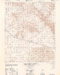
1960 Map of Bagdad
USGS Topo · Published 1960About this map
Bagdad serves as a central point in this arid landscape, situated along the Atchison Topeka and Santa Fe railroad line. The mid-century geography is defined by a sparse network of rail stops and utility infrastructure, including a prominent Pipeline and Dike system cutting through the desert floor. The map records several localized human imprints, from the Cemetery near the main settlement to the Trojan (Site) and the distant Siberia siding to the west.
Find a feature on this map
22 named features on this map. Tap any name to fly to it.
Don’t see what you’re looking for? This feature index may not catch every label — zoom into the map to look around manually.
Map Details
Editions of this 1960 Bagdad Map
This is the sole edition of this map. No revisions or reprints were ever made.
Other maps of this area

1942 · Amboy
USGS Topo · 1:250,000

1943 · Amboy
USGS Topo · 1:250,000

1953 · San Bernardino
USGS Topo · 1:250,000

1954 · Needles
USGS Topo · 1:250,000

1954 · Bristol Lake NW
USGS Topo · 1:24,000

1954 · Amboy Crater
USGS Topo · 1:24,000

1954 · Bagdad SW
USGS Topo · 1:24,000

1954 · Ludlow SE
USGS Topo · 1:24,000

1955 · Lead Mountain
USGS Topo · 1:24,000

1955 · Lead Mtn. NE
USGS Topo · 1:24,000