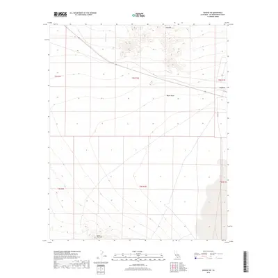
2018 Map of Bagdad SW
USGS Topo · Published 2018About this map
Bagdad and the surrounding desert corridor are the primary focus of this 2018 survey within the Mojave Desert. The landscape is dominated by stark geological formations, including the dark contours of the Lava Hills to the north and the rising slopes of the Bullion Mountains at the southern edge of the sheet. Modern infrastructure follows the path of the legendary Route 66, which bisects the northern half of the map alongside a major railway line. This transit corridor crosses Siberia Wash, reflecting how transportation routes in this part of San Bernardino County have long been dictated by the natural drainage patterns of the basin. The map provides a contemporary look at the intersection of historical transit routes and the open terrain of the high desert.
Find a feature on this map
13 named features on this map. Tap any name to fly to it.
Don’t see what you’re looking for? This feature index may not catch every label — zoom into the map to look around manually.
Map Details
Editions of this 2018 Bagdad SW Map
This is the sole edition of this map. No revisions or reprints were ever made.
Other maps of this area

1942 · Amboy
USGS Topo · 1:250,000

1943 · Amboy
USGS Topo · 1:250,000

1953 · San Bernardino
USGS Topo · 1:250,000

1954 · Needles
USGS Topo · 1:250,000

1954 · Amboy Crater
USGS Topo · 1:24,000

1954 · Bagdad SW
USGS Topo · 1:24,000

1954 · Ludlow SE
USGS Topo · 1:24,000

1955 · Lead Mountain
USGS Topo · 1:24,000

1955 · Lead Mtn. NE
USGS Topo · 1:24,000

1955 · Deadman Lake NE
USGS Topo · 1:24,000