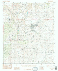
1986 Map of Bagdad
USGS Topo · Published 1986About this map
The industrial town of Bagdad dominates this Yavapai County landscape, revealing the infrastructure of a major Arizona mining operation in the mid-1980s. A large Conveyor Belt and several Water Tanks serve the area, while a series of Tailings Ponds occupy the valleys between Copper Creek Mesa and Sanders Mesa. The settlement itself is densely plotted with roads and a Drive-in, situated just south of the local Airport.
Find a feature on this map
50 named features on this map. Tap any name to fly to it.
Don’t see what you’re looking for? This feature index may not catch every label — zoom into the map to look around manually.
Map Details
Editions of this 1986 Bagdad Map
2 editions found
Other maps of this area

1923 · Signal
USGS Topo · 1:250,000

1942 · Signal
USGS Topo · 1:250,000

1945 · Bagdad
USGS Topo · 1:62,500

1948 · Bagdad
USGS Topo · 1:62,500

1950 · Prescott
USGS Topo · 1:250,000

1954 · Prescott
USGS Topo · 1:250,000

1958 · Prescott
USGS Topo · 1:250,000

1959 · Prescott
USGS Topo · 1:250,000

1960 · Prescott
USGS Topo · 1:250,000

1965 · Prescott
USGS Topo · 1:250,000