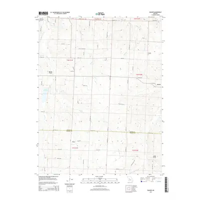
2014 Map of Bahner
USGS Topo · Published 2014About this map
The boundary between Pettis and Benton Counties bisects this rural landscape, where small agricultural settlements like Bahner and Mora anchor a network of country roads. The terrain is defined by the drainage systems of Spring Fork, Walnut Cr, and Lake Cr, which carve through the farmland to the south and west. In the northwest corner, Spring Fork Lake provides a localized water feature near the community of Spring Fork.
Find a feature on this map
63 named features on this map. Tap any name to fly to it.
Don’t see what you’re looking for? This feature index may not catch every label — zoom into the map to look around manually.
Map Details
Editions of this 2014 Bahner Map
This is the sole edition of this map. No revisions or reprints were ever made.
Other maps of this area

1887 · Sedalia
USGS Topo · 1:125,000

1887 · Warsaw
USGS Topo · 1:125,000

1894 · Warsaw
USGS Topo · 1:125,000

1894 · Sedalia
USGS Topo · 1:125,000

1944 · Sedalia West
USGS Topo · 1:24,000

1944 · Sedalia East
USGS Topo · 1:24,000

1946 · Sedalia West
USGS Topo · 1:24,000

1946 · Sedalia East
USGS Topo · 1:24,000

1947 · Jefferson City
USGS Topo · 1:250,000
1948 · Green Ridge
USGS Topo · 1:62,500