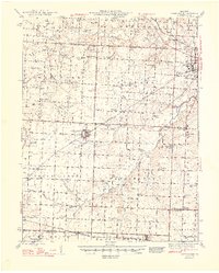
1948 Map of Green Ridge
USGS Topo · Published 1948About this map
Green Ridge sits at the heart of this landscape, serving as a hub for the Missouri-Kansas-Texas rail line in the late 1940s. The region is defined by a dense network of country schools and rural churches, such as Walnut Branch Ch and Bethlehem Ch, which anchored small farming communities before the consolidation of the mid-20th century. To the northeast, the outskirts of Sedalia appear near the State Fair Grounds, while the southern reaches cross into Benton County near Ionia. Evidence of local industry is found at Old Coal Mines in the Elk Fork township and scattered quarries. The drainage patterns of Flat Creek and Muddy Creek dictate the terrain, while landmarks like Huston Landing Field and Campbell Siding highlight the intersection of early aviation and established rail transport during this postwar era.
Find a feature on this map
88 named features on this map. Tap any name to fly to it.
Don’t see what you’re looking for? This feature index may not catch every label — zoom into the map to look around manually.
Map Details
Editions of this 1948 Green Ridge Map
2 editions found
Other maps of this area

1885 · Warrensburg
USGS Topo · 1:125,000

1887 · Clinton
USGS Topo · 1:125,000

1887 · Sedalia
USGS Topo · 1:125,000

1887 · Warsaw
USGS Topo · 1:125,000

1887 · Warrensburg
USGS Topo · 1:125,000

1894 · Warsaw
USGS Topo · 1:125,000

1894 · Sedalia
USGS Topo · 1:125,000

1894 · Warrensburg
USGS Topo · 1:125,000

1894 · Clinton
USGS Topo · 1:125,000

1917 · Knobnoster
USGS Topo · 1:62,500