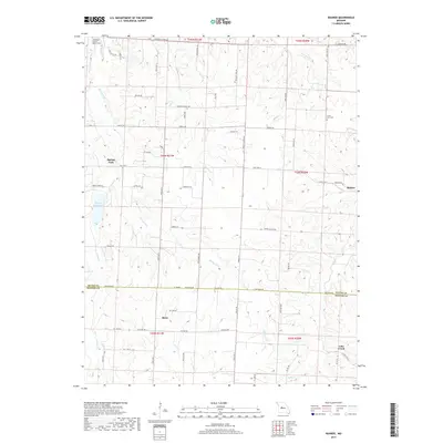
2017 Map of Bahner
USGS Topo · Published 2017About this map
Spring Fork and Bahner serve as focal points in this section of central Missouri, situated where the northern edge of the Ozark foothills meets the prairie. This 2017 survey details a landscape defined by its creek systems, including Walnut Cr, Mosby Cr, and Cheese Cr, which carve through the terrain between the Pettis and Benton County line. The area maintains its rural character with long-established landmarks such as the Bethlehem Baptist Church and its associated cemetery in the northwest, alongside the Lone Star Cem to the east. Local history is etched into the land via sites like the Walnut School and the recreational waters of Spring Fork Lake, reflecting a community centered around agriculture and local institutions. The map also captures the small settlement of Mora and the southern hamlet of Lake Creek, connected by a network of state highways and country roads like Pacific School Rd.
Find a feature on this map
68 named features on this map. Tap any name to fly to it.
Don’t see what you’re looking for? This feature index may not catch every label — zoom into the map to look around manually.
Map Details
Editions of this 2017 Bahner Map
This is the sole edition of this map. No revisions or reprints were ever made.
Other maps of this area

1887 · Sedalia
USGS Topo · 1:125,000

1887 · Warsaw
USGS Topo · 1:125,000

1894 · Warsaw
USGS Topo · 1:125,000

1894 · Sedalia
USGS Topo · 1:125,000

1944 · Sedalia West
USGS Topo · 1:24,000

1944 · Sedalia East
USGS Topo · 1:24,000

1946 · Sedalia West
USGS Topo · 1:24,000

1946 · Sedalia East
USGS Topo · 1:24,000

1947 · Jefferson City
USGS Topo · 1:250,000
1948 · Green Ridge
USGS Topo · 1:62,500