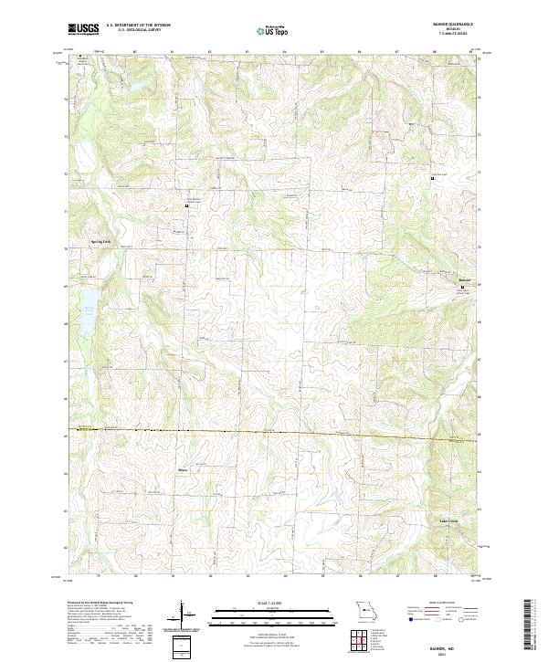
2021 Map of Bahner
USGS Topo · Published 2021About this map
Mora and Bahner anchor this rural landscape along the boundary of Pettis and Benton Counties. The area is characterized by a dense network of watercourses, including Spring Fork, Walnut Cr, and Mosby Cr, which carve through the terrain between small agricultural settlements. This 2021 update shows several historical religious and community sites that remain central to the region's identity, such as Bethlehem Baptist Church and its associated cemetery in the northwest.
Find a feature on this map
64 named features on this map. Tap any name to fly to it.
Don’t see what you’re looking for? This feature index may not catch every label — zoom into the map to look around manually.
Map Details
Editions of this 2021 Bahner Map
This is the sole edition of this map. No revisions or reprints were ever made.
Other maps of this area

1887 · Sedalia
USGS Topo · 1:125,000

1887 · Warsaw
USGS Topo · 1:125,000

1894 · Warsaw
USGS Topo · 1:125,000

1894 · Sedalia
USGS Topo · 1:125,000

1944 · Sedalia West
USGS Topo · 1:24,000

1944 · Sedalia East
USGS Topo · 1:24,000

1946 · Sedalia West
USGS Topo · 1:24,000

1946 · Sedalia East
USGS Topo · 1:24,000

1947 · Jefferson City
USGS Topo · 1:250,000
1948 · Green Ridge
USGS Topo · 1:62,500