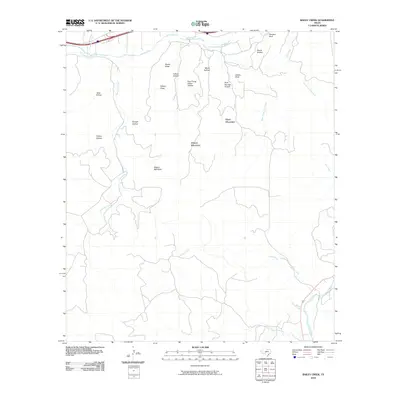
2010 Map of Bailey Creek
USGS Topo · Published 2010About this map
Allison Mountain and Black Mountain dominate the topography of this Kimble County landscape, where the drainage systems of the North Llano River and South Llano River converge. The terrain is defined by a dense network of draws and hollows that carry local family and descriptive names, reflecting the ranching heritage of the Texas Hill Country. Notable features include the winding path of Bois d'Arc Creek and the distinctive Sanders Bluff in the northeast. This 2010 survey illustrates a primarily rural environment where transportation is dictated by the limestone-carved valleys, specifically through paths like Allison Draw and Wagon Bed Draw. The map provides a clear record of the area's natural hydrology, from the primary river forks to smaller tributaries like Ratliff Creek and Cajac Creek, which shape the accessibility and land use of the region.
Find a feature on this map
25 named features on this map. Tap any name to fly to it.
Don’t see what you’re looking for? This feature index may not catch every label — zoom into the map to look around manually.
Map Details
Editions of this 2010 Bailey Creek Map
This is the sole edition of this map. No revisions or reprints were ever made.
Other maps of this area

1893 · Rock Springs
USGS Topo · 1:125,000

1893 · Fort McKavett
USGS Topo · 1:125,000

1926 · Segovia 2-c
USGS Topo · 1:48,000

1932 · Junction
USGS Topo · 1:62,500

1954 · Llano
USGS Topo · 1:250,000

1954 · Sonora
USGS Topo · 1:250,000

1955 · Llano
USGS Topo · 1:250,000

1956 · Llano
USGS Topo · 1:250,000

1958 · Sonora
USGS Topo · 1:250,000

1962 · Hill Ranch
USGS Topo · 1:24,000