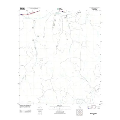
2012 Map of Bailey Creek
USGS Topo · Published 2012About this map
Black Mtn and Allison Mtn rise above a landscape defined by an intricate network of limestone drainages in this portion of Kimble County. The northern boundary is marked by the N Llano River, which flows alongside Ranch Road 1674 and through the deep cuts of Indian Hollow. The terrain is etched with numerous named draws and hollows, such as Wagon Bed Draw and Snake Draw, reflecting the local vernacular for this karst topography. Evidence of vital water sources in this arid environment appear at Rock Springs and Coleman Springs, which likely served as anchors for early ranching activity. To the south, the S Llano River winds through the hills near Cajac Cr, while local routes like Burt Ranch Rd and KC 140 provide access to the high ground of Sanders Bluff and the cattle country surrounding Turkey Hollow.
Find a feature on this map
41 named features on this map. Tap any name to fly to it.
Don’t see what you’re looking for? This feature index may not catch every label — zoom into the map to look around manually.
Map Details
Editions of this 2012 Bailey Creek Map
This is the sole edition of this map. No revisions or reprints were ever made.
Other maps of this area

1893 · Rock Springs
USGS Topo · 1:125,000

1893 · Fort McKavett
USGS Topo · 1:125,000

1926 · Segovia 2-c
USGS Topo · 1:48,000

1932 · Junction
USGS Topo · 1:62,500

1954 · Llano
USGS Topo · 1:250,000

1954 · Sonora
USGS Topo · 1:250,000

1955 · Llano
USGS Topo · 1:250,000

1956 · Llano
USGS Topo · 1:250,000

1958 · Sonora
USGS Topo · 1:250,000

1962 · Hill Ranch
USGS Topo · 1:24,000