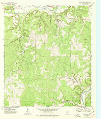
1974 Map of Bailey Creek
USGS Topo · Published 1977About this map
The North Llano River and South Llano River define the hydrology of this Kimble County landscape as it was recorded in the mid-1970s. The terrain is deeply incised by a network of drainage ways like Wagon Bed Draw, Snake Draw, and Allison Draw, highlighting the erosional patterns typical of the Edwards Plateau. Prominent elevations such as Allison Mountain and Black Mountain rise above the drainage basins of Copperas Creek and Bois d'Arc Creek. This survey period marks a point when energy infrastructure was becoming integrated into the rural landscape, evidenced by several Gas Well sites and a prominent Pipeline corridor. The presence of numerous watering points, including Indian Spring, Rock Springs, and Bear Spring, suggests a landscape historically managed for livestock and resource extraction. Significant local watercourses like Bailey Spring Creek and Cajac Creek flow through the southern reaches, connecting the upland draws to the primary river system.
Find a feature on this map
35 named features on this map. Tap any name to fly to it.
Don’t see what you’re looking for? This feature index may not catch every label — zoom into the map to look around manually.
Map Details
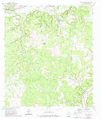
Editions of this 1974 Bailey Creek Map
2 editions found
Other maps of this area

1893 · Rock Springs
USGS Topo · 1:125,000

1893 · Fort McKavett
USGS Topo · 1:125,000

1926 · Segovia 2-c
USGS Topo · 1:48,000

1932 · Junction
USGS Topo · 1:62,500

1954 · Llano
USGS Topo · 1:250,000

1954 · Sonora
USGS Topo · 1:250,000

1955 · Llano
USGS Topo · 1:250,000

1956 · Llano
USGS Topo · 1:250,000

1958 · Sonora
USGS Topo · 1:250,000

1962 · Hill Ranch
USGS Topo · 1:24,000