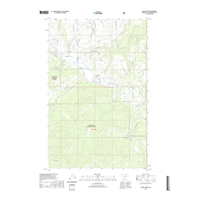
2020 Map of Bailey Creek
USGS Topo · Published 2020About this map
Aeneas Valley sits at the heart of this landscape, where high-country drainage systems converge toward the West Fork Sanpoil River. This area of the Okanogan National Forest is defined by its network of canyons and remote mountain aviation points, including Sourdough Airport and Hart Ranch Airport. The topography is marked by significant water features such as Cathcart Cecile Lake, Round Lake, and the hidden Squirrel Spring tucked away in the central forest. The southern portion of the map rises toward the summit of Bailey Mtn, overlooking the dramatic terrain of Devils Canyon. Local road names like Ruby Two Moons Rd and Tall Pines Rd trace the residential and forest access routes that connect these high-elevation valleys. The mapping detail shows a transition from structured land parcels in the valley floor to the protected wilderness of the national forest.
Find a feature on this map
62 named features on this map. Tap any name to fly to it.
Don’t see what you’re looking for? This feature index may not catch every label — zoom into the map to look around manually.
Map Details
Editions of this 2020 Bailey Creek Map
This is the sole edition of this map. No revisions or reprints were ever made.
Other maps of this area

1902 · Osoyoos
USGS Topo · 1:125,000

1904 · Osoyoos
USGS Topo · 1:125,000

1904 · Republic
USGS Topo · 1:125,000

1951 · Wauconda
USGS Topo · 1:62,500

1952 · Disautel
USGS Topo · 1:62,500

1953 · Bald Knob
USGS Topo · 1:62,500

1954 · Okanogan
USGS Topo · 1:250,000

1957 · Aeneas Valley
USGS Topo · 1:62,500

1958 · Okanogan
USGS Topo · 1:250,000

1958 · Aeneas
USGS Topo · 1:62,500