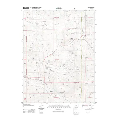
2013 Map of Bailey
USGS Topo · Published 2013About this map
Pike National Forest serves as the backdrop for this high-altitude landscape, where the North Fork South Platte River carves a path through the Front Range. The map details a transition from ranching heritage to residential clusters, with numerous family-named properties like Isham Jones Ranch, Potter Ranch, and Shaffer Ranch scattered across the mountain draws. Settlement centers are anchored by Bailey and Pine Junction, while smaller locales such as Glenisle, Insmont, and Estabrook line the river corridor. This survey documents the complex network of mountain roads and gulches that define local geography, including Quiner Gulch and Roland Gulch. For local historians and genealogists, the map identifies specific burial sites including Glen Isle Point Cem, Horn Cem, and Pine Gulch Cem, providing precise locations for these community landmarks within the varied terrain of Mount Bailey and Dick Mountain.
Find a feature on this map
158 named features on this map. Tap any name to fly to it.
Don’t see what you’re looking for? This feature index may not catch every label — zoom into the map to look around manually.
Map Details
Editions of this 2013 Bailey Map
This is the sole edition of this map. No revisions or reprints were ever made.
Other maps of this area

1893 · Platte Canyon
USGS Topo · 1:125,000

1899 · West Denver
USGS Topo · 1:125,000

1903 · Georgetown
USGS Topo · 1:62,500

1905 · Georgetown
USGS Topo · 1:62,500

1945 · Pine
USGS Topo · 1:24,000

1945 · Bailey
USGS Topo · 1:24,000

1945 · Shawnee
USGS Topo · 1:24,000

1948 · Pine
USGS Topo · 1:24,000

1948 · Shawnee
USGS Topo · 1:24,000

1949 · Bailey
USGS Topo · 1:24,000