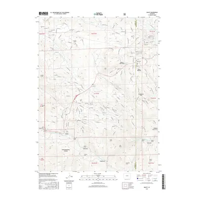
2016 Map of Bailey
USGS Topo · Published 2016About this map
The North Fork South Platte River carves a central path through this mountain landscape, anchoring a string of canyon floor settlements including Bailey, Insmont, and Estabrook. Large portions of the terrain are managed within the Pike National Forest, where the relief is defined by prominent features like Mt Bailey, Crow Hill, and Lone Rock. This 2016 survey illustrates the modern residential patterns that have emerged along the river corridor and its tributary gulches, with neighborhoods like Wandcrest Park and Will-O-The-Wisp established amidst the older rural infrastructure.
Find a feature on this map
177 named features on this map. Tap any name to fly to it.
Don’t see what you’re looking for? This feature index may not catch every label — zoom into the map to look around manually.
Map Details
Editions of this 2016 Bailey Map
This is the sole edition of this map. No revisions or reprints were ever made.
Other maps of this area

1893 · Platte Canyon
USGS Topo · 1:125,000

1899 · West Denver
USGS Topo · 1:125,000

1903 · Georgetown
USGS Topo · 1:62,500

1905 · Georgetown
USGS Topo · 1:62,500

1945 · Pine
USGS Topo · 1:24,000

1945 · Bailey
USGS Topo · 1:24,000

1945 · Shawnee
USGS Topo · 1:24,000

1948 · Pine
USGS Topo · 1:24,000

1948 · Shawnee
USGS Topo · 1:24,000

1949 · Bailey
USGS Topo · 1:24,000