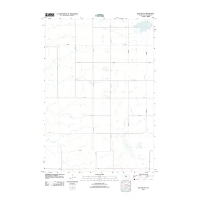
2012 Map of Baileys Lake
USGS Topo · Published 2012About this map
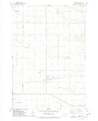
Baileys Lake sits in the northeast corner of this agricultural landscape in Clark County, South Dakota. The terrain is defined by a dense network of seasonal wetlands and glacial depressions, characteristic of the Prairie Pothole Region. A rigid grid of section-line roads, such as 165th St and 420th Ave, partitions the land into the large rectangular plots typical of Great Plains farming. Aside from these thoroughfares and scattered farmstead sites, the map reveals a largely open territory where natural drainage patterns and prairie potholes are the primary geographic features. This 2012 survey by the U.S. Geological Survey provides a precise record of the local hydrography and the rural infrastructure connecting this part of the county.
Find a feature on this map
15 named features on this map. Tap any name to fly to it.
Don’t see what you’re looking for? This feature index may not catch every label — zoom into the map to look around manually.
Map Details
Editions of this 2012 Baileys Lake Map
This is the sole edition of this map. No revisions or reprints were ever made.
Other maps of this area

1953 · Milbank
USGS Topo · 1:250,000

1953 · Watertown
USGS Topo · 1:250,000

1958 · Milbank
USGS Topo · 1:250,000

1958 · Watertown
USGS Topo · 1:250,000
1973 · Crocker SW
USGS Topo · 1:24,000

1973 · Bradley
USGS Topo · 1:24,000
1973 · Crocker
USGS Topo · 1:24,000
1973 · Baileys Lake
USGS Topo · 1:24,000
1973 · Raymond
USGS Topo · 1:24,000

1973 · Clark South
USGS Topo · 1:24,000