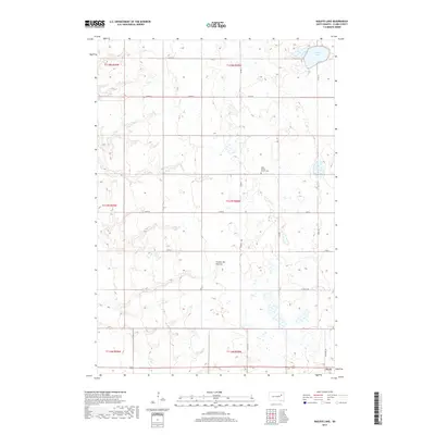
2017 Map of Baileys Lake
USGS Topo · Published 2017About this map
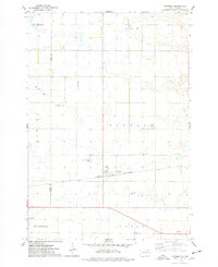
Coteau des Prairies defines the rolling glacial landscape of this Clark County map, characterized by a complex network of wetlands and small prairie potholes typical of eastern South Dakota. In the northern reaches of this highland, Baileys Lake stands as the primary water body, surrounded by an organized grid of section lines and county roads that reflect the region's agricultural layout. Central to the local community is the Clark Center Church Cem, providing a significant touchstone for genealogists and local historians tracking family roots in this rural township. This 2017 survey also captures the northern edge of Clark, the county seat, where the transition from open prairie to more concentrated settlement begins along the southern map boundary.
Find a feature on this map
26 named features on this map. Tap any name to fly to it.
Don’t see what you’re looking for? This feature index may not catch every label — zoom into the map to look around manually.
Map Details
Editions of this 2017 Baileys Lake Map
This is the sole edition of this map. No revisions or reprints were ever made.
Other maps of this area

1953 · Milbank
USGS Topo · 1:250,000

1953 · Watertown
USGS Topo · 1:250,000

1958 · Milbank
USGS Topo · 1:250,000

1958 · Watertown
USGS Topo · 1:250,000
1973 · Crocker SW
USGS Topo · 1:24,000

1973 · Bradley
USGS Topo · 1:24,000
1973 · Crocker
USGS Topo · 1:24,000
1973 · Baileys Lake
USGS Topo · 1:24,000
1973 · Raymond
USGS Topo · 1:24,000

1973 · Clark South
USGS Topo · 1:24,000