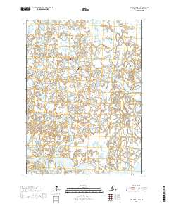
2017 Map of Baird Inlet B-2 SW
USGS Topo · Published 2017About this map
Tuntutuliak occupies a central position within this delta landscape, serving as a primary settlement node amidst a dense network of waterways. The 2017 survey details the essential infrastructure of the area, notably the Tuntutuliak Airport, which provides a critical connection to the interior and coastal regions of Alaska. The surrounding terrain is defined by the wandering paths of the Kinak River, Jewn River, and Tagayarak River, showing a complex hydrology typical of the Bethel area. These braided rivers and the myriad small lakes between them illustrate a world where water dictates the patterns of movement and residence, providing a clear view of the environmental context that shapes life in this subarctic region.
Find a feature on this map
9 named features on this map. Tap any name to fly to it.
Don’t see what you’re looking for? This feature index may not catch every label — zoom into the map to look around manually.
Map Details
Editions of this 2017 Baird Inlet B-2 SW Map
This is the sole edition of this map. No revisions or reprints were ever made.
Other maps of this area

1951 · Baird Inlet
USGS Topo · 1:250,000

1954 · Baird Inlet A-3
USGS Topo · 1:63,360

1954 · Baird Inlet
USGS Topo · 1:250,000
1954 · Baird Inlet A-2
USGS Topo · 1:63,360

1954 · Baird Inlet B-3
USGS Topo · 1:63,360
1954 · Baird Inlet B-2
USGS Topo · 1:63,360
2017 · Baird Inlet A-3 NE
USGS Topo · 1:25,000
2017 · Baird Inlet B-3 NE
USGS Topo · 1:25,000
2017 · Baird Inlet A-2 NE
USGS Topo · 1:25,000
2017 · Baird Inlet A-2 NW
USGS Topo · 1:25,000