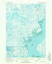
1954 Map of Baird Inlet B-2
USGS Topo · Published 1971About this map
The Kuskokwim River dominates the southeastern portion of this mid-century survey, revealing a landscape defined by an intricate network of tidal channels and wetland tundra. Small seasonal or permanent settlements like Tuntutuliak and Akulurak sit perched near the water's edge, reflecting the subsistence and transportation patterns of the Yukon-Kuskokwim Delta. The hydrology here is remarkably complex, with the Kialik River, Kinak River, and Jewn River meandering through a mosaic of countless small lakes and ponds.
Find a feature on this map
12 named features on this map. Tap any name to fly to it.
Don’t see what you’re looking for? This feature index may not catch every label — zoom into the map to look around manually.
Map Details
Editions of this 1954 Baird Inlet B-2 Map
2 editions found
Other maps of this area

1951 · Baird Inlet
USGS Topo · 1:250,000

1954 · Baird Inlet A-3
USGS Topo · 1:63,360

1954 · Baird Inlet
USGS Topo · 1:250,000

1954 · Baird Inlet B-1
USGS Topo · 1:63,360
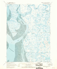
1954 · Baird Inlet A-1
USGS Topo · 1:63,360
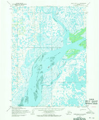
1954 · Baird Inlet C-1
USGS Topo · 1:63,360
1954 · Baird Inlet C-2
USGS Topo · 1:63,360
1954 · Baird Inlet A-2
USGS Topo · 1:63,360
1954 · Baird Inlet C-3
USGS Topo · 1:63,360

1954 · Baird Inlet B-3
USGS Topo · 1:63,360