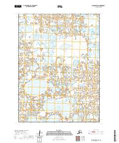
2020 Map of Baird Inlet B-4 SE
USGS Topo · Published 2020About this map
Glacial lakes and intricate wetlands dominate this 2020 U.S. Geological Survey topographic study of the Baird Inlet region. The landscape is a labyrinth of water and marsh, partitioned by the Public Land Survey System boundaries of T3n R81w, T3n R80w, T2n R81w, and T2n R80w. This specific quadrangle captures a subarctic wilderness defined by its absence of permanent human infrastructure, roads, or named settlements. Instead, it offers a purely hydrological and topographical view of the Bethel Census Area, illustrating how the tundra's drainage patterns and small pond clusters define the western Alaskan interior.
Find a feature on this map
4 named features on this map. Tap any name to fly to it.
Don’t see what you’re looking for? This feature index may not catch every label — zoom into the map to look around manually.
Map Details
Editions of this 2020 Baird Inlet B-4 SE Map
This is the sole edition of this map. No revisions or reprints were ever made.
Other maps of this area

1951 · Baird Inlet
USGS Topo · 1:250,000

1954 · Baird Inlet A-3
USGS Topo · 1:63,360

1954 · Baird Inlet
USGS Topo · 1:250,000

1954 · Baird Inlet B-3
USGS Topo · 1:63,360
1954 · Baird Inlet B-4
USGS Topo · 1:63,360
1954 · Baird Inlet A-4
USGS Topo · 1:63,360
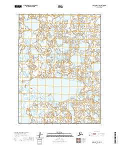
2020 · Baird Inlet B-4 NW
USGS Topo · 1:25,000
2020 · Baird Inlet A-4 NE
USGS Topo · 1:25,000
2020 · Baird Inlet B-4 NE
USGS Topo · 1:25,000
2020 · Baird Inlet B-4 SW
USGS Topo · 1:25,000