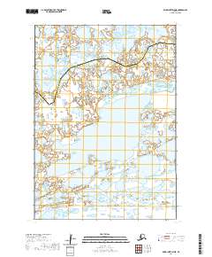
2020 Map of Baird Inlet D-7 NE
USGS Topo · Published 2020About this map
Widgeon Lake sits in the southern portion of this landscape, a region defined by an intricate network of wetlands and small water bodies. The terrain is marked by the jurisdictional boundary separating the Kusilvak Census Area from the Bethel Census Area, which zig-zags across the northern half of the quadrangle. This area of Alaska, near the Baird Inlet D-7 NE region, represents a largely undeveloped wilderness where the primary features are defined by the natural hydrography and public land survey divisions. The map provides a precise layout of townships and ranges, such as t11n r85w and t10n r85w, which are essential for identifying land tracts in this remote part of the state. The absence of roads or established settlements emphasizes the reliance on waterways and seasonal navigation through the expansive marshlands.
Find a feature on this map
8 named features on this map. Tap any name to fly to it.
Don’t see what you’re looking for? This feature index may not catch every label — zoom into the map to look around manually.
Map Details
Editions of this 2020 Baird Inlet D-7 NE Map
This is the sole edition of this map. No revisions or reprints were ever made.
Other maps of this area

1951 · Marshall
USGS Topo · 1:250,000

1951 · Baird Inlet
USGS Topo · 1:250,000

1954 · Baird Inlet D-6
USGS Topo · 1:63,360

1954 · Marshall A-6
USGS Topo · 1:63,360
1954 · Marshall A-7
USGS Topo · 1:63,360

1954 · Baird Inlet D-7
USGS Topo · 1:63,360

1954 · Marshall
USGS Topo · 1:250,000

1954 · Baird Inlet
USGS Topo · 1:250,000
2020 · Marshall A-7 SW
USGS Topo · 1:25,000
2020 · Marshall A-6 SW
USGS Topo · 1:25,000