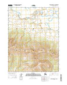
2015 Map of Baird Mountains A-4 SW
USGS Topo · Published 2015About this map
Kiana Hills dominates the southeastern quadrant of this terrain study, where the elevation rises steeply from the river valleys. The northern portion of the map is defined by the winding course of the Squirrel River, which meanders across a broad, low-lying floodplain. This arctic landscape showcases a transition from the complex, braided hydrology of the Kagboo Cr drainage to the high ridges of the inland hills. The absence of roads or permanent settlements within these townships emphasizes the isolation of this region within the Northwest Arctic Borough. The intricate contour lines provided by the U.S. Geological Survey detail the sharp contrast between the saturated river bottoms and the high, dry ground of the uplands during the mid-2010s.
Find a feature on this map
7 named features on this map. Tap any name to fly to it.
Don’t see what you’re looking for? This feature index may not catch every label — zoom into the map to look around manually.
Map Details
Editions of this 2015 Baird Mountains A-4 SW Map
This is the sole edition of this map. No revisions or reprints were ever made.
Other maps of this area

1951 · Baird Mountains
USGS Topo · 1:250,000

1951 · Selawik
USGS Topo · 1:250,000

1955 · Selawik D-4
USGS Topo · 1:63,360

1955 · Selawik D-5
USGS Topo · 1:63,360
1955 · Baird Mountains A-5
USGS Topo · 1:63,360

1955 · Baird Mountains A-4
USGS Topo · 1:63,360

1956 · Baird Mountains
USGS Topo · 1:250,000

1957 · Selawik
USGS Topo · 1:250,000

1965 · Baird Mountains
USGS Topo · 1:250,000
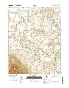
2014 · Baird Mountains A-5 NE
USGS Topo · 1:25,000