
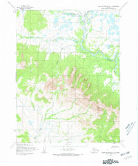
1955 Map of Selawik D-4
USGS Topo · Published 1968About this map
The Kobuk River dominates this mid-century landscape in the Northwest Arctic, winding through a complex system of waterways and islands. This environment is characterized by the branching Melvin Channel, Nazuruk Channel, and Oksik Channel, which carve through the Native Reservation. This mapping, derived from 1955 aerial photography, documents the subsistence landscape of the region, noting isolated outposts like the Tenmile Post and several cabins along the riverbanks. To the south, the terrain rises toward the Hockley Hills and the prominent Hotham Peak, providing a sharp contrast to the marshy lowlands of the river delta. A few trails are indicated, marking the traditional routes of travel across this remote expanse before significant modern development.
Map Details
Editions of this 1955 Selawik D-4 Map
This is the sole edition of this map. No revisions or reprints were ever made.
Other maps of this area

1951 · Baird Mountains
USGS Topo · 1:250,000

1951 · Selawik
USGS Topo · 1:250,000

1955 · Selawik D-5
USGS Topo · 1:63,360

1955 · Selawik C-3
USGS Topo · 1:63,360

1955 · Selawik C-5
USGS Topo · 1:63,360

1955 · Selawik D-3
USGS Topo · 1:63,360
1955 · Baird Mountains A-5
USGS Topo · 1:63,360

1955 · Selawik C-4
USGS Topo · 1:63,360

1955 · Baird Mountains A-3
USGS Topo · 1:63,360

1955 · Baird Mountains A-4
USGS Topo · 1:63,360