
1955 Map of Baird Mountains A-3
USGS Topo · Published 1970About this map
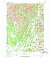
The Kallarichuk Hills dominate this mid-century wilderness landscape, rising sharply above the complex drainage systems of the Squirrel River. In 1955, this region of the Northwest Arctic remained largely roadless, defined instead by the Winter Trail and a remote Squirrel River Landing Strip used for access. The map reveals a sparse network of human presence through isolated Cabins tucked along the banks of Klery Creek and Martha Creek. These scattered structures and the reliance on seasonal trails highlight a traditional subsistence and prospecting era before modern infrastructure reached deep into the interior. Numerous watercourses including Canyon Creek and Otter Creek carve through the high elevations, illustrating the intricate hydrology of the Baird Mountains before later environmental shifts or developments impacted these pristine watersheds.
Find a feature on this map
16 named features on this map. Tap any name to fly to it.
Don’t see what you’re looking for? This feature index may not catch every label — zoom into the map to look around manually.
Map Details
Editions of this 1955 Baird Mountains A-3 Map
This is the sole edition of this map. No revisions or reprints were ever made.
Other maps of this area

1951 · Baird Mountains
USGS Topo · 1:250,000

1951 · Selawik
USGS Topo · 1:250,000

1955 · Selawik D-2
USGS Topo · 1:63,360

1955 · Baird Mountains A-2
USGS Topo · 1:63,360

1955 · Selawik D-4
USGS Topo · 1:63,360

1955 · Selawik D-3
USGS Topo · 1:63,360

1955 · Baird Mountains B-3
USGS Topo · 1:63,360
1955 · Baird Mountains B-4
USGS Topo · 1:63,360

1955 · Baird Mountains A-4
USGS Topo · 1:63,360

1956 · Baird Mountains
USGS Topo · 1:250,000