
1955 Map of Baird Mountains A-2
USGS Topo · Published 1959About this map
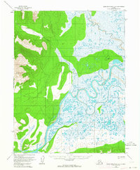
The Kobuk River snakes through this Northwest Arctic landscape, its winding path defining a complex system of oxbows and wetlands. Mapped from aerial photography taken in the mid-1950s, the terrain reveals an untouched wilderness where drainage patterns are dictated by the Kallariehuk River and smaller tributaries like Trinity Creek. The surveyor's presence is marked by high-altitude triangulation stations, including VABM 2487 Kitty and VABM Goldie 32, which anchor the topography of the Baird Mountains. To the southeast, the lowlands become increasingly saturated, characterized by the meandering flows of Etaroniluk Creek and Tutitook Creek. This survey captures the region's hydrography and elevation before any modern infrastructure altered the natural movement of the water across the tundra.
Find a feature on this map
8 named features on this map. Tap any name to fly to it.
Don’t see what you’re looking for? This feature index may not catch every label — zoom into the map to look around manually.
Map Details
Editions of this 1955 Baird Mountains A-2 Map
3 editions found
Other maps of this area

1951 · Baird Mountains
USGS Topo · 1:250,000

1951 · Selawik
USGS Topo · 1:250,000

1955 · Baird Mountains A-1
USGS Topo · 1:63,360

1955 · Selawik D-2
USGS Topo · 1:63,360
1955 · Selawik D-1
USGS Topo · 1:63,360

1955 · Selawik D-3
USGS Topo · 1:63,360

1955 · Baird Mountains B-3
USGS Topo · 1:63,360

1955 · Baird Mountains A-3
USGS Topo · 1:63,360

1956 · Baird Mountains
USGS Topo · 1:250,000

1957 · Selawik
USGS Topo · 1:250,000