
1955 Map of Baird Mountains B-3
USGS Topo · Published 1970About this map
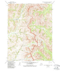
The Kalarichuk Hills dominate the southern half of this mid-century topographic survey, where steep elevations rise sharply from the drainage basins. Originally mapped by the Army Map Service, the terrain reflects an untouched Arctic landscape defined by its intricate river systems and tributary networks. In the south, the headwaters of Klery Creek and Gold Run Creek cut through the high ground, while the northern reaches are shaped by the broader paths of the Nikok River and the Kitlik River.
Find a feature on this map
9 named features on this map. Tap any name to fly to it.
Don’t see what you’re looking for? This feature index may not catch every label — zoom into the map to look around manually.
Map Details
Editions of this 1955 Baird Mountains B-3 Map
2 editions found
Other maps of this area

1951 · Baird Mountains
USGS Topo · 1:250,000

1955 · Baird Mountains A-2
USGS Topo · 1:63,360

1955 · Baird Mountains C-4
USGS Topo · 1:63,360

1955 · Baird Mountains A-3
USGS Topo · 1:63,360
1955 · Baird Mountains B-4
USGS Topo · 1:63,360

1955 · Baird Mountains C-3
USGS Topo · 1:63,360

1955 · Baird Mountains A-4
USGS Topo · 1:63,360

1956 · Baird Mountains
USGS Topo · 1:250,000

1965 · Baird Mountains
USGS Topo · 1:250,000
1990 · Baird Mountains B-2
USGS Topo · 1:63,360